|
Leftmenu
|
Gallery 2011: November 25-27, Ouachita National Recreation Trail
Pass your mouse over the thumbnails to view photos and captions.
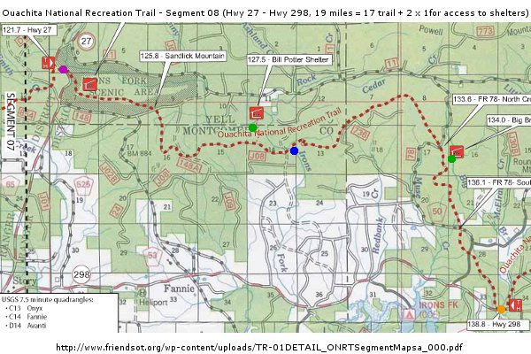 Purple dot: trail head; green dots: shelters; red line: approximate trail; blue dot: Irons Fork crossing; orange tot: trail end Purple dot: trail head; green dots: shelters; red line: approximate trail; blue dot: Irons Fork crossing; orange tot: trail end
The trail was very rugged and sometimes not easy to find.
About 17 miles of trail, plus 2 times 1 mile round trip to and from the shelters. The trail was easy to moderate. The shelters were located by the water, so steep climb to get back on the trail in the morning.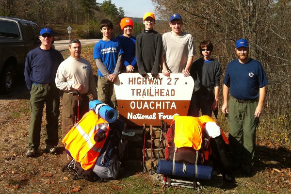 At the trail head. From left to right: ASM Philippe Van Houtte, ASM Mike Garrison, SPL Chase, Garrett, Maxim, ASPL Jake, Siam, and ASM Gregg Vickers. Departure around 12:00pm. At the trail head. From left to right: ASM Philippe Van Houtte, ASM Mike Garrison, SPL Chase, Garrett, Maxim, ASPL Jake, Siam, and ASM Gregg Vickers. Departure around 12:00pm.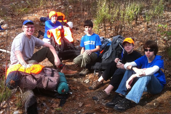 Time for a rest Time for a rest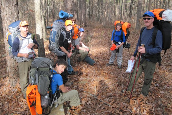 And another stop And another stop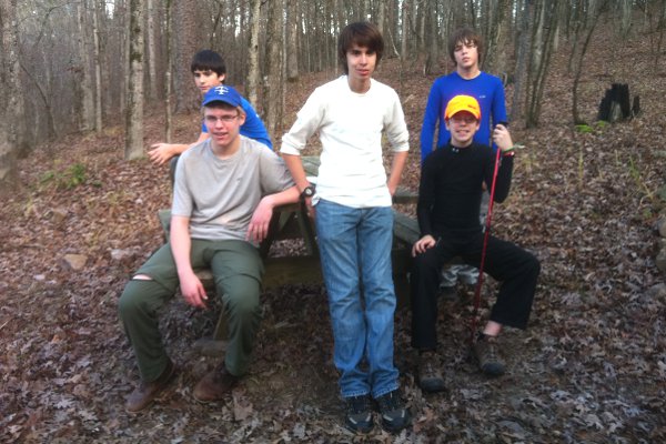 Arrival at the Bill Potter Shelter at 4:00 pm Arrival at the Bill Potter Shelter at 4:00 pm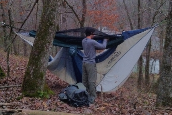 Chase hangs up his hammock. Chase hangs up his hammock.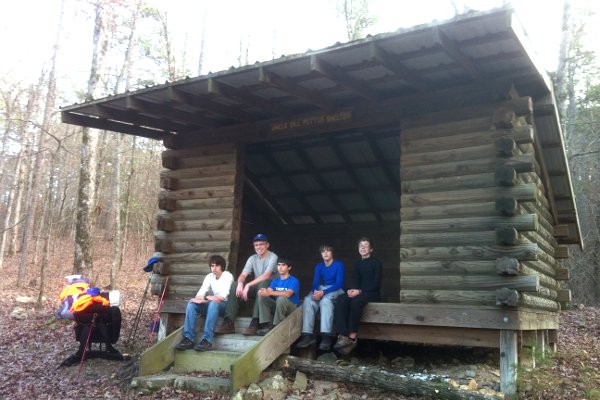 The shelter was awesome. The weather was nice and we built a nice fire. ASM Philippe and Maxim cooked sausages on embers... The shelter was awesome. The weather was nice and we built a nice fire. ASM Philippe and Maxim cooked sausages on embers...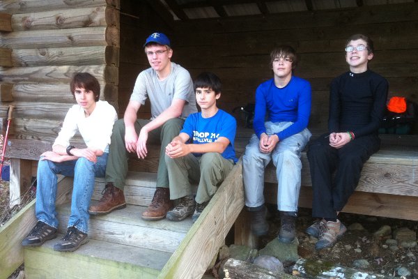 Siam, Jake, Chase, Garrett, and Maxim taking a rest. Siam, Jake, Chase, Garrett, and Maxim taking a rest.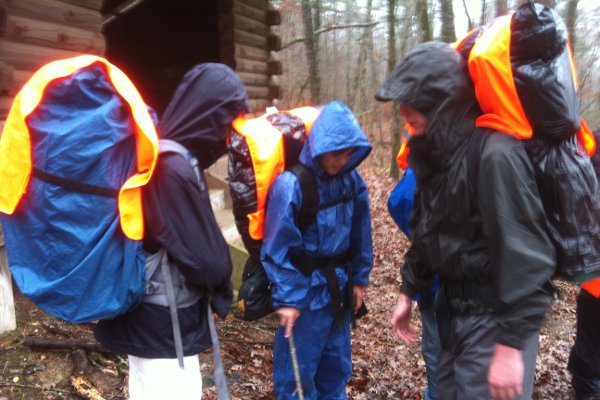 Saturday morning, it started raining around 8:00 am. Everyone gets prepared with rain gear. Saturday morning, it started raining around 8:00 am. Everyone gets prepared with rain gear.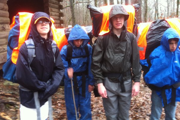 We are all prepared for this. We are all prepared for this.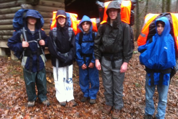 We hit the trail, still under the rain, around 8:45 am. We hit the trail, still under the rain, around 8:45 am.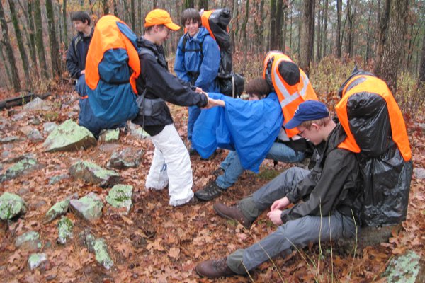 Always with a smile, even in the rain... Always with a smile, even in the rain...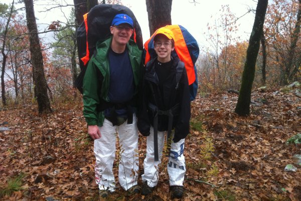 Baron von Tyvek and son Maxim Baron von Tyvek and son Maxim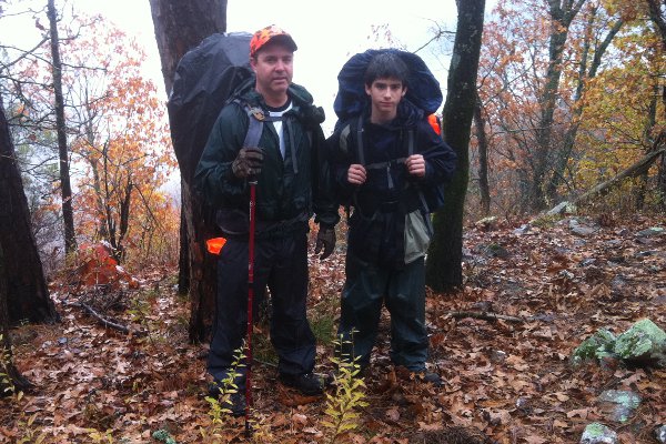 ASM Mike and son Chase ASM Mike and son Chase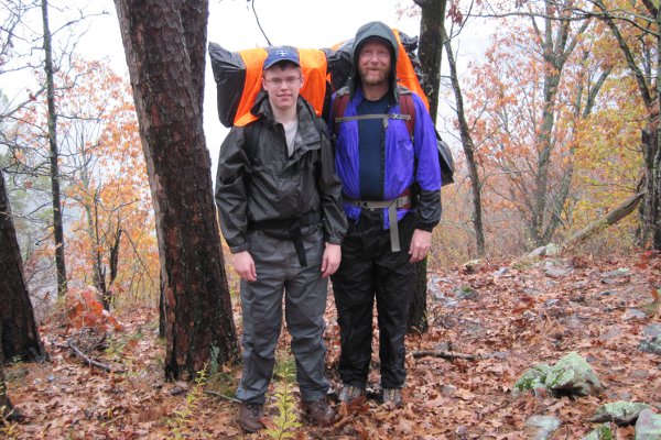 ASM Gregg and son Jake ASM Gregg and son Jake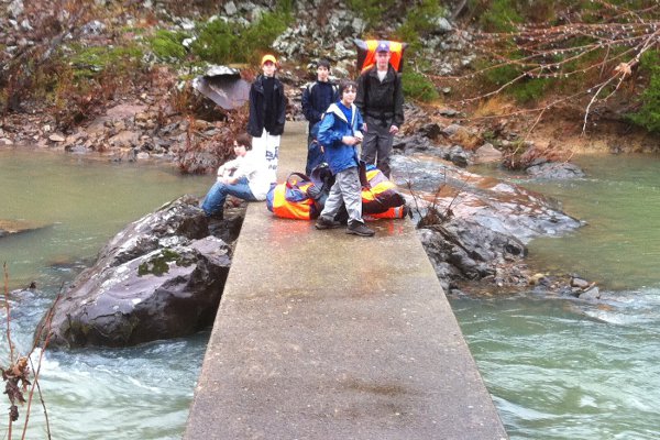 Crossing the Irons Fork Creek (blue spot on map) Crossing the Irons Fork Creek (blue spot on map) 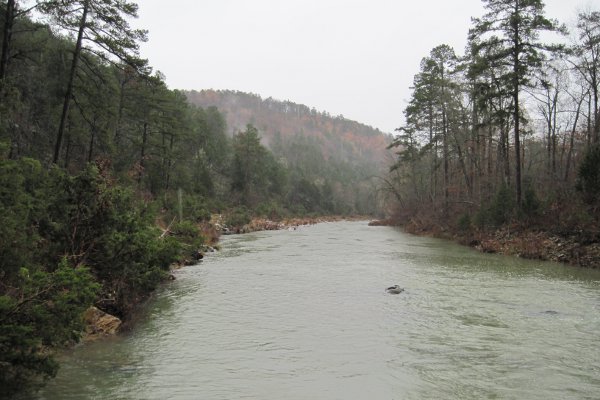 Irons Fork Creek downstream from the concrete crossing bridge Irons Fork Creek downstream from the concrete crossing bridge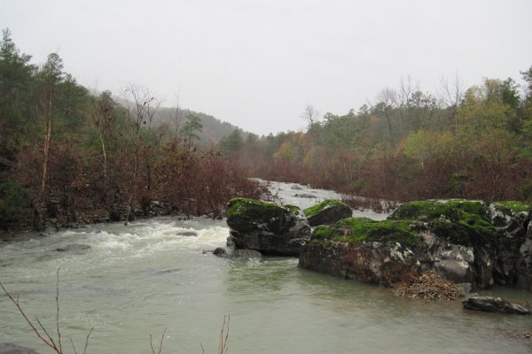 Irons Fork Creek upstream from the concrete crossing bridge Irons Fork Creek upstream from the concrete crossing bridge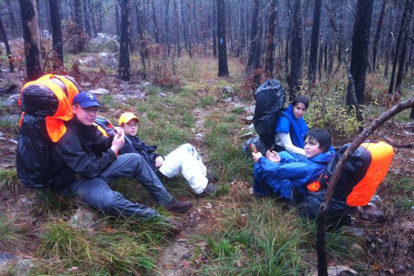 Rain or no rain, time for a break! Rain or no rain, time for a break!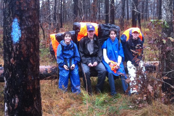 About lunch time on Saturday About lunch time on Saturday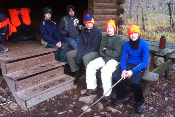 We reached the Big Branch Shelter around 4:00 pm. We reached the Big Branch Shelter around 4:00 pm.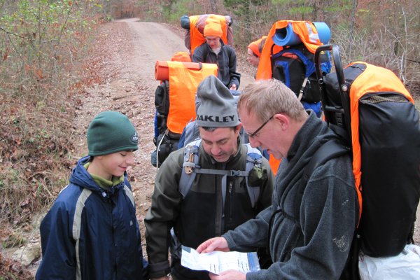 Map check Map check Some parts of the trail were wide enough for three hikers to walk together one next to the other. From left to right: Siam, Maxim, and Jake. Some parts of the trail were wide enough for three hikers to walk together one next to the other. From left to right: Siam, Maxim, and Jake.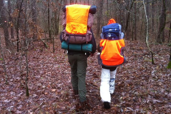 Jake and Maxim Jake and Maxim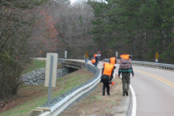 Highway 298, meeting with SM Patrick Highway 298, meeting with SM Patrick
|